Transforming Agriculture with LiDAR Technology
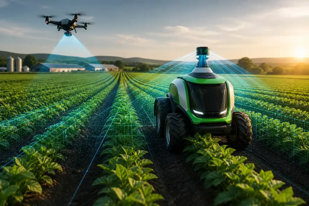
Agriculture has always been a data-driven industry—farmers rely on timing, precision, and efficiency to stay competitive. As autonomous and semi-autonomous vehicles become more common in the field, LiDAR (Light Detection and Ranging) technology is emerging as one of the most valuable sensing tools for modern farms.
Unlike traditional camera systems, LiDAR sensors capture accurate, three-dimensional data about the environment—regardless of lighting or weather conditions. This makes LiDAR ideal for critical agricultural tasks such as mapping, navigation, crop monitoring, and collision avoidance, especially in dusty, variable, and outdoor environments where optical sensors struggle.
Applications of LiDAR in Agriculture
1. Field Mapping and Terrain Modeling
LiDAR enables precise 3D mapping of farmlands, creating elevation models that support better irrigation planning, drainage control, and yield prediction. Mounted on drones, tractors, or autonomous rovers, LiDAR scanners capture millions of data points per second to model the land’s surface and vegetation structure.
This helps farmers:
- Identify low spots and water pooling areas,
- Optimize planting patterns, and
- Plan routes for autonomous equipment based on terrain.
Compared to traditional GPS-only mapping, LiDAR provides vertical accuracy within centimeters, allowing operators to plan with far greater precision.
2. Autonomous Navigation and Path Planning
In autonomous tractors and sprayers, LiDAR acts as the primary perception layer—detecting terrain contours, plants, and obstacles in real time.
LiDAR enables:
- Reliable localization and obstacle detection,
- Safe operation in low-visibility environments (dust, dusk, or fog), and
- Continuous operation without relying on external lighting or GPS alone.
Because agricultural machinery typically moves at low speeds, short-range LiDARs with wide fields of view (120–360°) are ideal. These sensors provide dense environmental data around the vehicle, ensuring safe and precise navigation without requiring the long detection ranges needed in automotive highway applications.
3. Crop Monitoring and Biomass Estimation
LiDAR’s ability to measure plant height, canopy density, and volume makes it a valuable tool for crop health monitoring.
When mounted on drones or ground vehicles, LiDAR can:
- Measure vegetation indices without the interference of changing sunlight,
- Identify areas of uneven growth, and
- Estimate biomass for yield forecasting or fertilizer optimization.
These capabilities make LiDAR a core technology for precision agriculture, complementing multispectral and hyperspectral imagery to give a more complete picture of crop performance.
4. Collision Avoidance and Safety
On autonomous or operator-assisted equipment, LiDAR sensors provide real-time obstacle detection to prevent collisions with animals, humans, and farm infrastructure.
The wide field of view and dense point cloud generated by LiDAR ensures full situational awareness—even when working in narrow rows, around silos, or near other machinery.
Integrating LiDAR with radar and cameras creates a robust sensor fusion system that maintains safe operation even when dust or mud obstruct visual sensors.
LiDAR vs. Camera Systems for Agriculture
| Feature | LiDAR | Camera |
| Lighting Dependence | Works in any lighting; unaffected by glare, shadows, or night | Performance drops in low light or strong glare |
| Dust/Fog Performance | Reliable in dusty or foggy environments | Visibility often severely degraded |
| Depth Accuracy | Provides true 3D distance measurements | Relies on visual inference; limited accuracy |
| Data Output | Produces detailed point clouds for terrain, crop, and object analysis | Produces 2D color images; requires advanced AI to interpret |
| Computational Load | Lighter—direct geometric data | Heavier—requires training and interpretation |
| Cost Trend | Falling rapidly as LiDAR becomes more compact and scalable | Mature and inexpensive, but less reliable for autonomy |
While cameras are valuable for classification (e.g., identifying plant species or disease), LiDAR excels at spatial perception, making it essential for navigation, mapping, and real-time safety systems. The most effective agricultural systems often use both—LiDAR for geometry and depth, cameras for visual context.
Short-Range, Wide Field-of-View LiDAR: The Right Fit for Agriculture
Unlike passenger cars that travel at highway speeds, farm equipment typically operates at 5–15 mph, meaning it doesn’t need long-range sensors designed for 200-meter detection.
Instead, agricultural vehicles benefit from short- to medium-range LiDAR sensors (20–80 m) with wide horizontal and vertical fields of view.
Advantages of this configuration include:
- Complete situational awareness around slow-moving vehicles
- Simpler integration and lower power consumption
- Reduced cost compared to long-range automotive LiDAR
- Improved obstacle detection in near-field environments, such as crop rows or orchard paths
Sensors such as Seyond, Ouster, and Hesai short-range LiDAR models are increasingly used on tractors, harvesters, and autonomous sprayers for exactly this reason.
Efficiency Gains Through Autonomous Operations
LiDAR-enabled autonomy allows farm machinery to operate around the clock, even in poor visibility or low light, dramatically improving productivity.
Autonomous navigation reduces operator fatigue, improves precision in planting and spraying, and ensures consistency across large fields.
Benefits include:
- Reduced labor costs and operator dependency
- Improved input efficiency (fertilizer, water, pesticides)
- Fewer collisions and lower equipment downtime
- Scalable operations that keep pace with rising food demand
Ultimately, LiDAR makes autonomy more practical and reliable—helping transform farming into a data-driven, continuous, and sustainable process.
The Future of LiDAR in Agriculture
As LiDAR sensors continue to become smaller, cheaper, and more robust, their adoption across agricultural machinery will accelerate.
Next-generation models offer solid-state reliability, longer lifespans, and integration-ready interfaces for tractors, drones, and ground robots.
In the near future, farms will rely on LiDAR-based perception layers for nearly every autonomous function—from mapping and spraying to harvesting and logistics—enabling smarter, safer, and more efficient food production worldwide.
In summary:
LiDAR is no longer just for self-driving cars—it’s rapidly becoming the backbone of autonomous agriculture.
Its ability to see in 3D, operate in any condition, and detect the world with unmatched precision is reshaping how we farm, harvest, and manage land.
